

Additional features
-
Night mode
Uzbekcosmos to monitor soil salinity with satellite imagery
The agency Uzbekcosmos has launched a pilot project to monitor soil salinity using satellite imagery, covering 90 agricultural plots in the Jizzakh region. This initiative aims to facilitate Uzbekistan's development of strategies for soil restoration and sustainable land resource management.
The project is implemented in collaboration with the United Nations Economic and Social Commission for Asia and the Pacific (ESCAP). Uzbekcosmos announced this initiative during a seminar attended by local and international experts.
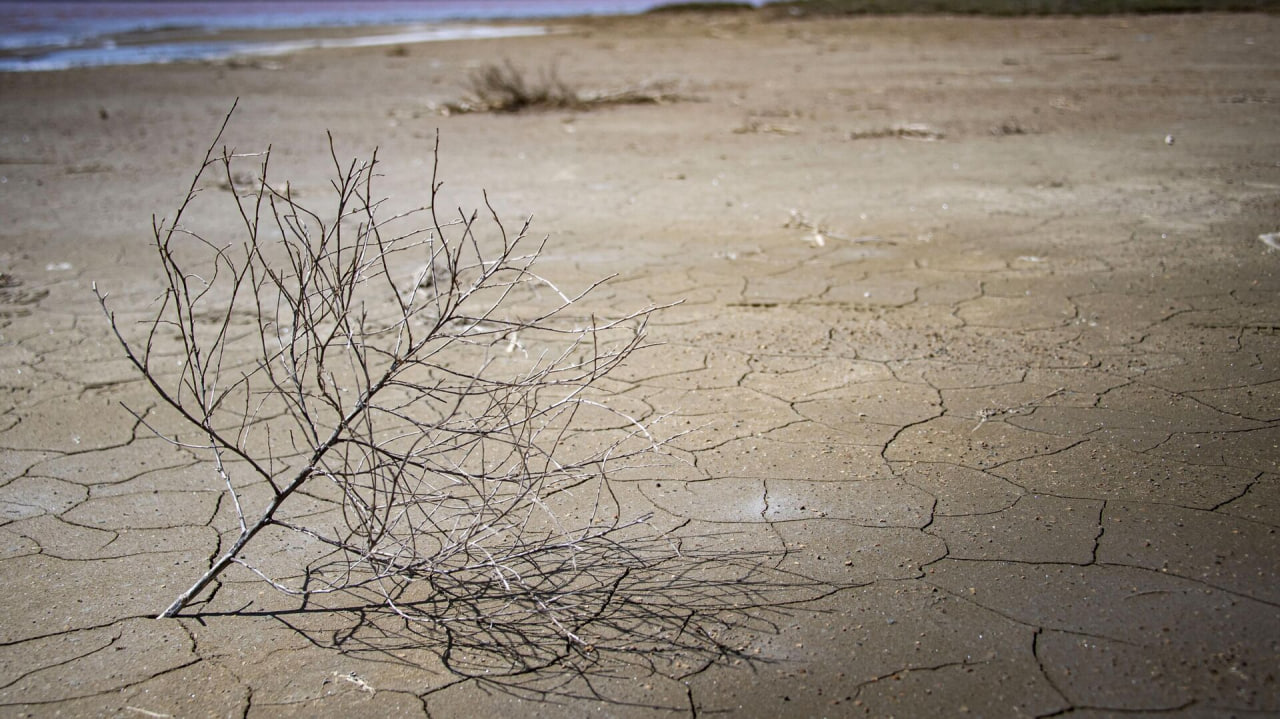
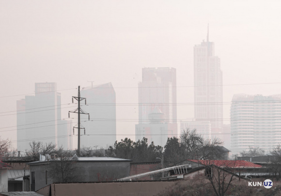
According to Uzbekcosmos, 1.74 million hectares of land in Uzbekistan are affected by varying degrees of salinity, with 65,200 hectares classified as severely saline. Furthermore, 5.5 million hectares have turned into salt flats due to the desiccation of the Aral Sea.
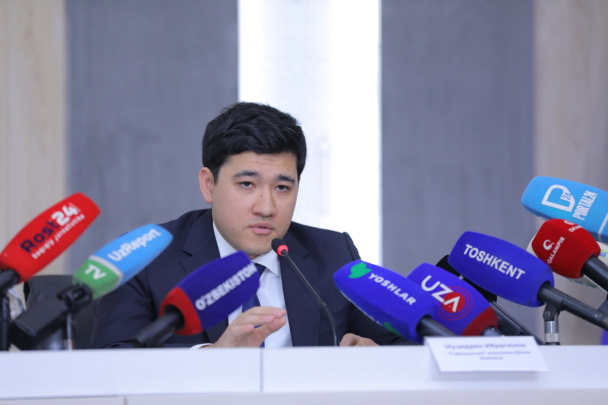
"Salinization reduces water availability for plants, degrades soil fertility, and leads to the loss of essential minerals and trace elements. As a result, monitoring and finding solutions in this area remains a high priority," explained Ismoil Rasulov, Head of the Department of Science, Innovations and Technology Transfer at Uzbekcosmos.
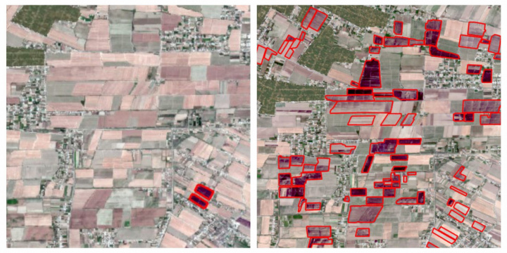
The project will monitor 90 agricultural areas in the Zarbdar district and surrounding territories in the Jizzakh region. Over the course of two years, specialists will assess the soil salinity levels in these areas. To evaluate this, the vegetation (NDVI) and salinity (SSI) indices will be employed, as explained by Farhod Mahmudkhodjaev, head of the Space Monitoring and Geoinformation Technology Center.
Both indices are derived from satellite images that capture not only the visible spectrum (RGB, which appears as a regular satellite image) but also infrared and other invisible wavelengths. The NDVI index will assess the state and density of vegetation, while the SSI index will measure the degree of soil salinity in the region.
However, the use of only these two indices for soil salinity monitoring may not be sufficient, noted Professor Miao Lu from the Chinese Academy of Agricultural Sciences. Additional vegetation indices can further improve the accuracy of the analysis. These include the Soil-Adjusted Vegetation Index (SAVI), the Ratio Vegetation Index (RVI), as well as specialized salinity indices like the Normalized Difference Salinity Index (NDSI) and Soil Salinity Indices (SSI).
Uzbekcosmos intends to consider these recommendations, but for the pilot project, which aims to demonstrate the feasibility of such monitoring, additional indices will not be used.
The project will reduce the need for large-scale field sampling, accelerate data collection, lower laboratory research costs, and automate soil salinity assessments, said Farhod Mahmudkhodjaev. Monitoring soil salinity across vast areas will become more efficient, making it easier to identify affected zones and decreasing the volume of field research.
Thanks to satellite imagery and the indices used, specialists will be able to quickly identify areas with a high likelihood of salinity, thereby reducing survey costs. Soil samples will be collected only from potentially problematic areas, with parameters later verified in laboratories.
The agency is in preliminary negotiations with the Research Institute of Soil Science and Agrochemistry, which will provide laboratory facilities for analysis.
"This approach will simplify the development of strategies for land resource management," concluded Farhod Mahmudkhodjaev.
ESCAP economic expert Kareff Rafisura noted that the global objective of the initiative is to enhance data collection and analysis. This will help track Uzbekistan’s progress toward achieving the Sustainable Development Goals (SDGs). Based on the findings, ESCAP will tailor international standards for ecological and agricultural solutions to Uzbekistan's conditions.
Kareff Rafisura added that the project will also strengthen the capacity of government agencies by leveraging artificial intelligence and creating an open data platform. This is especially important for strategic planning related to soil restoration and land resource management.
The space monitoring data will be provided to government bodies, including the ministries of ecology, agriculture, and water management, said Ismoil Rasulov. Additionally, an open geoplatform will be created, allowing users to access land resource analytics. This will be the first Uzbekcosmos project to offer open access to such data.
"While separate portals have been created for many space monitoring projects, the information contained within them is restricted because it includes government data and registries. We only share this information with government institutions. However, in this project, supported by an international organization, data openness is one of the key requirements of our partners," explained Ismoil Rasulov.
Recommended
List of streets and intersections being repaired in Tashkent published
SOCIETY | 19:12 / 16.05.2024
Uzbekistan's flag flies high on Oceania's tallest volcano
SOCIETY | 17:54 / 15.05.2024
New tariffs to be introduced in Tashkent public transport
SOCIETY | 14:55 / 05.05.2023
Onix and Tracker cars withdrawn from sale
BUSINESS | 10:20 / 05.05.2023
Latest news
-
Massive embezzlement uncovered at Andijan State University: Rector, chief accountant and other officials jailed
SOCIETY | 20:36 / 07.07.2025
-
Uzbekistan's economy expands 6.8% in first half of 2025
SOCIETY | 20:34 / 07.07.2025
-
Heatwave triggers nearly 250,000 emergency calls across Uzbekistan
SOCIETY | 20:31 / 07.07.2025
-
Why medicines cost more in Uzbekistan? Pharmaceutical Agency chief explains
SOCIETY | 18:21 / 07.07.2025
Related News
19:18 / 18.06.2025
Uzbekcosmos detects over 200 field fires across Uzbekistan via satellite monitoring
15:48 / 28.03.2025
Five key risks for Uzbekistan’s progress and how to overcome them
11:49 / 17.01.2025
Uzbekistan to collaborate with Turkic states on satellite launch

18:34 / 24.10.2024